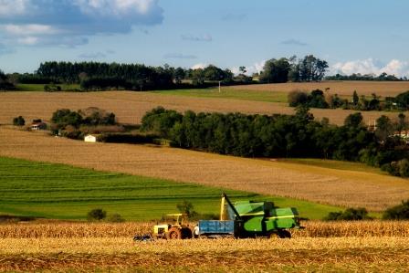
Compared to traditional methods of gathering aerial images Unmanned Air Systems will provide you with a low cost alternative without compromising on quality. Using an appropriate UAS and processing software it is possible to generate Geo Referenced aerial imagery with resolutions of up to 2.5cm/pixel resolution.

This makes it now feasible and practical to gather data for purposes such as locating harvest sites and inspecting forestry operations, precision Farming (e.g. to determine the degree of weeds for site specific herbicide applications), determination of the biomass crop growth and food quality. There are also applications to monitor and detect changes within areas where access is difficult or undesirable.